

Introduction: Why Tracking Lake Elevations Matters
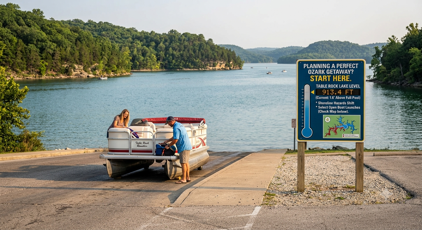
Planning a perfect weekend getaway to the Ozarks starts with checking a few crucial details before backing your boat down the ramp. Knowing the current Table Rock Lake level can change how you approach your day on the water. It affects hidden underwater hazards near the shoreline and which boat launches are open.
Anglers, boaters, and local property owners watch these metrics to stay safe and catch more fish. Water levels shift with seasonal rainfall and power generation demands at the dam. Let’s look at how to find real-time numbers and read official tracking data like a pro.
Table Rock Lake Facts and Operational Benchmarks
To help you understand official numbers from government tracking agencies, here is a quick guide to the lake’s structural benchmarks.
| Elevation Benchmark | Measurement (Feet) | Operational Significance |
| Normal Top of Conservation | 915.0 to 917.0 ft | Ideal target for summer recreation and boating |
| Top of Flood Control Pool | 931.0 ft | Maximum capacity is reserved to hold back flood waters |
| Top of Table Rock Dam | 947.0 ft | The physical crest of the concrete dam structure |
| Bottom of Power Pool | 881.0 ft | Minimum level needed to generate electricity safely |
| Historical Record High | 935.47 ft | Set during the historic floods of April 27, 2011 |
| Historical Record Low | 868.45 ft | All-time low depth reached in 1957 during filling |
Checking Table Rock Lake Level Today
If you plan to head out to the water, finding the Table Rock Lake level today is easy. The water line shifts slowly over 24 hours, depending on how much fluid passes through the dam’s turbines. Checking the gauge before you leave home prevents surprises at the marina.
For a clearer visual, you can look at an online map showing today’s Table Rock Lake level. These digital maps show which bays have plenty of depth and where shallow banks might be exposed. A visual layout helps you navigate safely around the lake’s 800-mile shoreline. Government Gauges
The water data we rely on comes from automated monitoring stations. Most local captains look directly at the Corps of Engineers reports on Table Rock Lake level and dam gates to balance flood control with regional electricity needs. A real-time tracking option is the USGS Table Rock Lake level database. The U.S. Geological Survey maintains digital sensors that stream live height data straight to the web. These official portals remove guesswork, so you know exactly what the Table Rock Lake level is at any given moment.
Table of Contents
Real-Time Updates and Live Water Tracking
If you want immediate shifts in depth, look up the Table Rock Lake level in today’s live stream tickers. These dashboards show hourly fluctuations and the total downstream volume in cubic feet per second. This data is critical if you plan to fish below the dam on the White River.
When packing your swim gear, also check the Table Rock Lake level and temperature averages. Water temperature affects where bass schools hide and whether the water is warm enough for swimming. Reviewing the combined Table Rock Lake level and temperature today helps keep your family comfortable all afternoon.

Predicting the Water Line: Forecasts and Projections
Boaters who store vessels in private slips must look ahead to avoid grounding issues during dry spells. Checking the Table Rock Lake level forecast gives a clear view of upcoming pool adjustments based on weather patterns. It tells you if you need to adjust your dock lines.
For immediate weekend plans, checking the forecast for Table Rock Lake level tomorrow keeps your schedule running smoothly. The Corps publishes predictions based on incoming rainfall and upstream reservoir conditions. Studying these projections lets you stay one step ahead of changing lake environments.
Finding the Current Levels Right Now
If you are standing on the dock wondering what the current Table Rock Lake level is, a quick phone search solves it. Typing Table Rock Lake level now into your browser brings up the latest automated gauge reading within seconds. The pool usually stays between 915 and 917 feet during peak summer months.
Experienced captains always know the current level of Table Rock Lake before letting passengers dive into unknown coves. High pools can submerge picnic tables and trees, creating hidden dangers just below the surface. Staying informed about the water level at Table Rock Lake is the best safety rule you can follow.
Exploring Historical Records and Low Points
To fully understand modern pool heights, it helps to examine the history of Table Rock Lake levels. The reservoir has undergone dramatic shifts over the past decades due to seasonal droughts and intense spring storms. These historical numbers show how the local dam system works.
The absolute Table Rock Lake level record low occurred in 1957, when the valley was initially filling. In modern history, severe weather has occasionally dropped the pool to the 880-foot mark. This exposes old foundations and historical roads usually buried beneath the waves.
High Water Marks and Flood Control
When heavy spring rains hit Missouri and Arkansas, the reservoir acts as a giant shield for downstream towns. The highest Table Rock Lake level ever recorded was 935.47 feet. This event occurred in spring 2011.
During high-water events, the Corps opens the spillway gates to relieve pressure on the valley. Knowing the Table Rock Lake level during a storm helps you determine whether park beaches will be temporarily closed. It shows the power of civil engineering in managing nature.
Quick Reference Guide for New Boaters
If you are still confused by the different pool terms, do not worry. Beginners often wonder what the current level of Table Rock Lake should be for summer tubing. The sweet spot on the gauge is around 915 feet.
When people ask what the lake level of Table Rock Lake is, they mean the elevation above sea level, not the actual water depth. A reading of 916 feet means the surface is 916 feet above sea level. Keeping this baseline in mind makes reading any public hydrologic report simple.
Summary of Tracking Options for Your Trip
When preparing your final checklist, remember there are multiple ways to find the lake level at Table Rock Lake. You can use smartphone apps, government websites, or local marina reports, and it only takes a minute to review the numbers before you head out.
Knowing the current lake level of Table Rock Lake gives you peace of mind. You can launch your boat confidently, find the best fishing drop-offs, and enjoy a safe vacation. Keep an eye on the gauges and have a blast exploring the beautiful Ozarks!
Frequently Asked Questions
What is considered full pool for Table Rock Lake?
The full pool is officially designated between 915 and 917 feet above sea level during the summer. When the water sits within this target zone, all public boat ramps, courtesy docks, and swim beaches operate as expected.
Where can I find live Table Rock Lake level data?
The most reliable live data is hosted on the website. The USGS water data portal also provides automatically updating charts that refresh throughout the day.
How does a high water level affect boating safety?
High water can submerge large logs, signposts, and low-lying points on islands just beneath the surface. It creates dangerous hidden hazards for boat hulls, so you must drive slowly and keep a sharp lookout.
Why does the lake level drop during the autumn months?
The Corps of Engineers intentionally lowers the water toward the winter pool target of 915 feet. This drawdown creates extra storage space in the reservoir to capture heavy rainfall during the upcoming spring.
Does the water level affect the quality of fishing?
Yes! Rising water pushes black bass into newly flooded shoreline brush to hunt for baitfish. Falling water forces the fish out of the shallows and into deeper drop-offs and standing timber structures.
Is Table Rock Lake safe for swimming right now?
Generally, yes! However, you should always check local water temperature and clarity reports after heavy storms. Avoid swimming near active boat lanes or directly below the roaring spillway gates of the dam.
Conclusion: Check the Numbers and Hit the Water!
Monitoring the Table Rock Lake level is the smartest habit any regular Ozark boater can develop. It keeps your passengers safe, protects your marine equipment, and helps you plan the ultimate day of sunshine and relaxation. So check the live gauges today, pack your cooler, and enjoy everything this spectacular lake has to offer!
